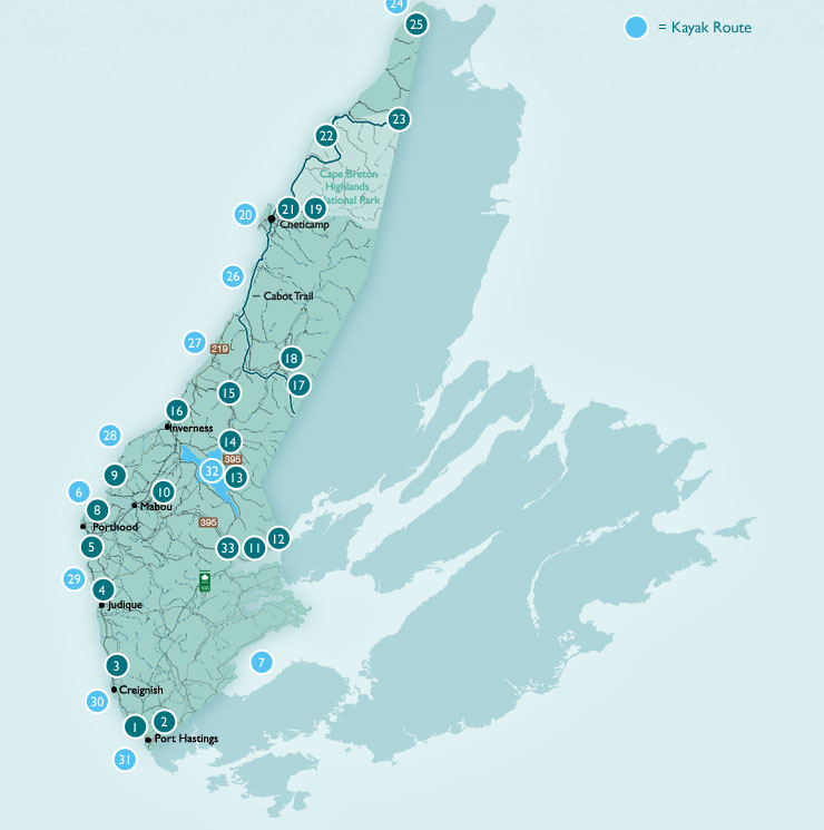
Cape Mabou Trails
The approximately 30 kilometers of trails ( hiking only )that make up the Cape Mabou Trails provide some of the finest hiking found in Nova Scotia. There are two main access points to the trail system. From the Inverness side the trailhead is located at the end of the rather narrow Sight Point Road. The other main access point is located approximately 12 kilometers from the village of Mabou, at the end of the Mabou Coal Mines Road. It is suggested that hikers purchase a detailed map of the trails, available locally.
The volunteer group, The Cape Mabou Trail Club, oversees the challenging task of maintaining this network of trails that takes in some of the most spectacular scenery on Cape Breton Island. Some of the trails follow old cart tracks once used by the many families that had settled here, and the Gaelic trail names are reflective of this history. The trails run through the Mabou Highlands, which are situated on the rugged and unspoiled coast of Inverness County.
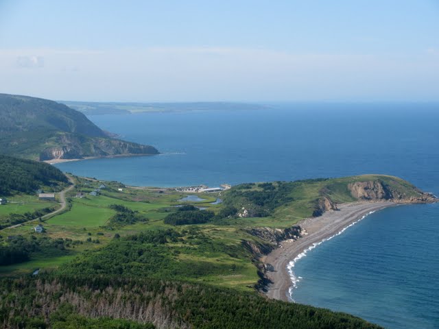
The looping nature of the trail system provides hikers with an opportunity to hike along the magnificent coastline, through hardwood valleys or to the top of scenic look offs where it is possible to spot pods of whales, bald headed eagles, fishing boats at work, or catch a glimpse of Prince Edward Island on the horizon . So whether you spend an hour (return) hiking to the first look off, or an entire day exploring, you will understand why people from all over the world are so fond of these trails.
When your day’s hiking is done, why not return to the village of Mabou and enjoy some food and drink in one of our fine local establishments.